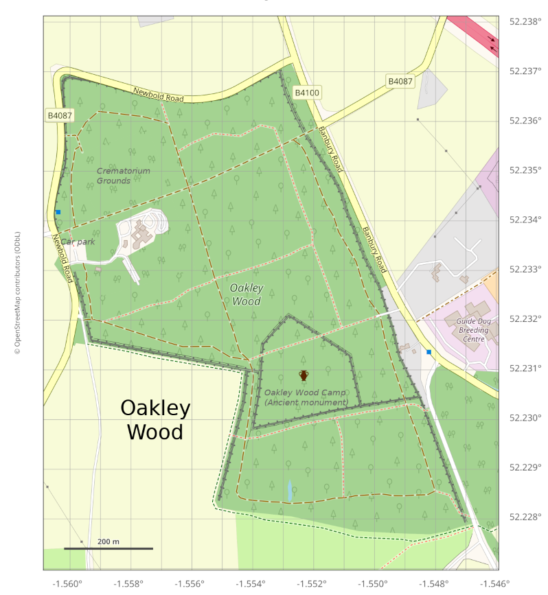
We’ve produced a map to help you find your way around the wood. This latest map uses GPS coordinates (latitude and longitude) as these are more relevant to today’s technologies, especially mobile phones.
A printable version of the map is here.
The map reflects the 2022 path upgrades, and the new compacted-surface paths are shown differently on the map from other paths. Also, we’ve removed most of the unofficial paths that were previously shown. Many of these had disappeared anyway (under-use, fallen trees, forestry work, etc). Unofficial paths come and go and really have no place on a fairly static map, so we’ve left them out.
See also the way-marked walking routes, which take you on specific paths around the wood. These routes are not all hard-surfaced but there are alternatives marked which make them reasonably suitable for wheelchairs and pushchairs. That’s not to say that there may not be the odd rough patch or a bit of mud in places when it’s wet.
Identifying a place in the wood
Sometimes you may need to identify a point on the map, perhaps to report something you’ve seen in the wood. This can be done in various ways:
- estimate the lat and lon by interpolating from the map scale lines e.g. the northern apex of the camp is approx. 51.2321,-1.5527 (51.2321 N, 1.5527 W).
- Google maps can show you the co-ordinates of a particular point on a map. However, a drawback of Google maps is that its focus is on roads and man-made objects, and generally does not map the countryside, including Oakley Wood.
- OpenStreetMap (OSM) has the benefit of mapping everything (its name is misleading – it doesn’t focus specifically on streets). It does not have its own phone app, but its maps are available (online and offline) through 3rd party apps. For more help in how to use OSM facilities, go here.
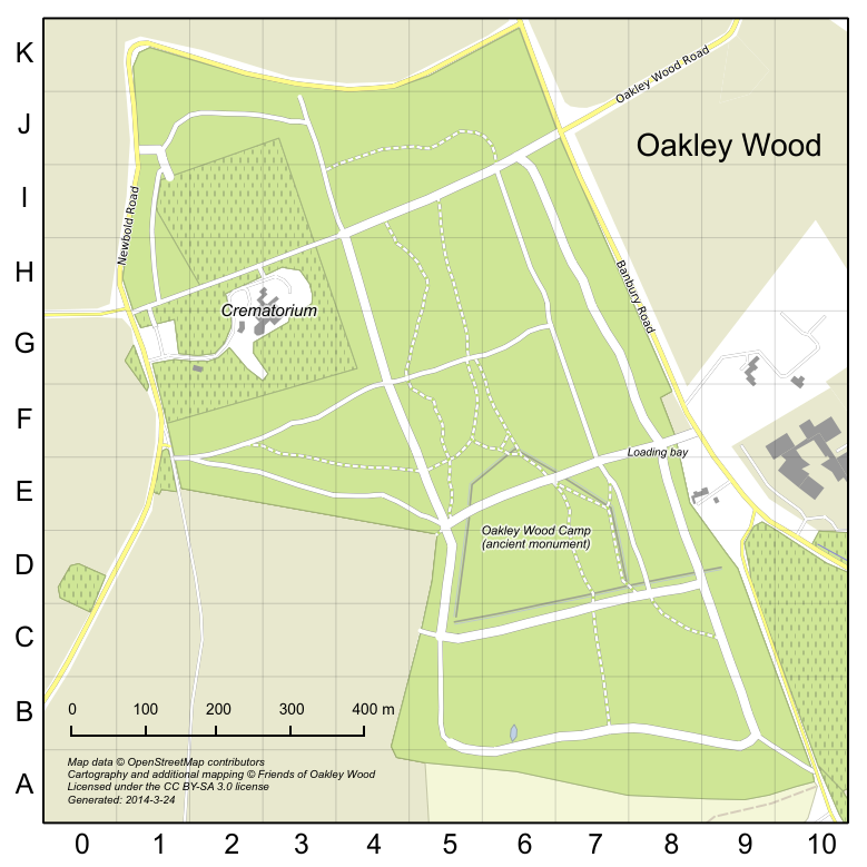
- using the old grid markings (A-K, 0-10). The old map showing this grid is shown below. The main map features are unchanged so a reference can still be determined, but note that the reference will only be accurate to “somewhere in the grid box”.
Note that using your phone’s GPS directly to find your position does not work well in places where the satellite signals are liable to be blocked e.g. amongst trees, unfortunately .
Old map with grid (for grid reference only)
Is cycling permitted in Oakley wood? I have seen a number cyclists recently but had Always assumed it was not a permissible bridle way.
The Friends of Oakley Wood aren’t responsible for deciding what can and can’t be done in the wood. I suggest you ask Warwick District Council if cycling is permitted. But I can tell you that there are no formal bridleways in Oakley Wood—the only public right of way is the footpath from G1 to J7.
Following another recent question on the subject, WDC has confirmed that cycling is not permitted anywhere in the wood.